An Introduction to Economy of Sikkim

An Introduction to Economy of Sikkim

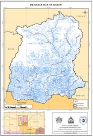
Sikkim is surrounded by vast stretches of Tibetan Plateaus in the north, the Chumbi Valley of Tibet and the Kingdom of Bhutan in the east, the Kingdom of Nepal in the west and Darjeeling district of West Bengal in the south. Sikkim has several snow-capped peaks including Kanchenjunga, the world’s third highest peak that attracts a large number of tourists from across the globe. The state has been able to bag seven out of 25 central government’s national projects to promote India as destination for adventure tourism globally.

The gross state domestic product (GSDP) of Sikkim expanded at a high compound annual growth rate (CAGR) of 19.44 per cent between 2004-05 and 2015-16.

There has been a drastic shift in the sectoral contribution from primary and tertiary to the secondary sector. In 2015-16, the secondary sector contributed 67.73 per cent to the state’s GSDP at current prices. It was followed by the tertiary sector at 23.65 per cent and primary sector at 8.62 per cent. Moreover, at a CAGR of 33.91 per cent, the secondary sector has been the fastest growing among the three sectors from 2004-05 to 2015-16. It was driven by manufacturing, construction and electricity, gas & water supply.

Agricultural Sector

The state’s economy is largely agrarian, based on the terraced farming of rice and the cultivation of crops such as maize, millet, wheat, barley, oranges, tea and cardamom. Sikkim produces more cardamom than any other Indian state, and is home to the largest cultivated area of cardamom

Sikkim has a suitable climate for agricultural and horticultural products. It supports multiple crops; viz., rice, wheat, maize, millet, barley, urad, pea, soya bean, mustard and large cardamom. Sikkim is the top producer of large cardamom, contributing over 80 per cent to India’s total production. As per the state budget 2016-17, Sikkim got certified as first fully organic state in India by the Central Ministry of Agriculture and Farmers’ Welfare as well as other recognized agencies of the country.

Organic Farming

Sikkim has been transformed as the first Organic State of the country and the world by design and have opened unlimited opportunities in sectors like Agriculture, Horticulture and Animal Husbandry.

Currently, state is exporting large cardamom, ginger, buckwheat, turmeric and cymbidium orchids. Our aim has been to fulfil the domestic market and export our surplus production outside the state.

Under the National Mission on Agricultural Extension & Training, new emerging organic technologies are being disseminated to the farmers through training, demonstration, farm schools, exposure visits, formation of commodity interests groups and food security groups, etc.

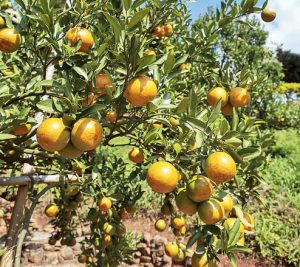
The Sikkim Organic Mission is introducing an e-voucher card system as an effective mechanism to distribute assistances under the Direct Benefit Transfer for ensuring that the Scheme’s funds are channeled directly to the beneficiaries. This would be a first of its kind initiative in Sikkim and probably in the Country as well.

Industrial Sector

There has been a drastic shift in the sectoral contribution from primary and tertiary to the secondary sector. The overall performance of the economy of the state during 2015-16 was encouraging. At a CAGR of 33.91%, the secondary sector witnessed the fastest growth among the three sectors during 2004-05 to 2015-16. It was driven by manufacturing, construction and electricity, gas & water supply. In 2015-16, the secondary sector contributed 67.73% to the state’s GSDP at current prices.

The state follows the North East Industrial Investment Promotion Policy, 2007, which provides several incentives and concessions for investment. Institutional support is provided through various central and state government agencies viz., North East Council, Ministry of Development of North Eastern Region and Commerce and Industries Department.

The main industries like Brewing, distilling, tanning and watchmaking are located in the southern regions of Sikkim.

A small mining industry exists in the state, extracting minerals such as copper, dolomite, talc, graphite, quartzite, coal, zinc and lead. Sikkim has identified Rangpo-Gangtok, Melli-Jorethang, Jorethang-Rishi and Ranipool-Gangtok as industrial corridors with provision for giving land to investors on a lease basis.

The units that are engaged in the manufacturing sector are mainly dealing with pharmaceuticals, chemicals, liquors, foam mattresses, food products, iron rods, etc.

Sikkim has identified agro-based industries, horticulture and floriculture, minor forest-based industries, animal husbandry and dairy products, tourism-related industries, IT including knowledge-based industries, precision oriented high value-low volume products, hydro-power, tea, education and hospitality as thrust sectors.

The Information Technology (IT) Department, Government of Sikkim is in the process of setting up a state-of-the-art IT Park and National Institute of Electronics and Information Technology (NIELIT) at Pakyong.

The state has attracted Foreign Direct Investment (FDI) equity inflows worth US$ 3.93 billion during the period April 2000 to March 2016, according to data released by Department of Industrial Policy and Promotion (DIPP).

Tertiary sector

Industrial sector was followed by the tertiary sector at 23.65% and primary sector at 8.62%. The tertiary sector grew at a CAGR of 15.23% between 2004-05 and 2015-16. The growth has been driven by trade, hotels, real estate, finance, insurance, transport, communications and other services. The primary sector grew at a CAGR of 15.55% between 2004-05 and 2015-16.

Tourism provides the main thrust to the economy. With the tranquil climate, the natural beauty and the fine cultural heritage of Sikkim, the growth of tourism has immense possibilities. There are large number of places of tourist attraction particularly the snow clad mountains, the lakes and unspoiled forest areas and valleys of flowers. The advantage of having very fine monasteries in Sikkim can also be taken to attract Buddhist tourists from countries like Japan and the South Eastern countries.

Sikkim was the first to promote the concept of eco-tourism, village tourism and home stay tourism in the country. This essential concept promoting man-nature affinity has been recognized as a new model of tourism.  Promotion of village tourism, homestay, cultural tourism, trekking tourism, ecotourism, wellness tourism, flori–tourism and adventure tourism has given fillip to the tourism trade in the state where a large of number of people are engaged under different employment opportunities.

Sikkim has been featured and ranked 17th in the New York Times “52 best places to go in 2017”. Similarly, Sikkim has also been featured as the best destination to visit in the world in 2014.

The Year 2017 has been declared as the Year of Sustainable Tourism for Development, an area of development in which Sikkim has already made considerable strides with eco-friendly tourism and the development of innovative initiatives such as Chaar Dham and Tathagatha Tsal. Additionally, Gangtok City has been recognized as the safest tourist destination in the country.

FDI inflows  into the state during April 2000 to March 2016 reached to US$ 3.93 billion. A major part of these investments was directed towards power generation There are 27 completed electricity projects in the state. The central government has invested heavily in the hydro electric power generation projects in Sikkim Himagiri Hydro Energy Pvt Ltd. started the initial construction work of their new project namely; 300 MW Panan hydro power project.

Recent Developments

Allocated budget for the industry and minerals sector in Sikkim is estimated to be US$ 9.46 million during 2016-17. Out of this total allocation, villages and small industries would be allocated US$ 5.97 million and large industries would be allocated US$ 2.75 million. The remaining US$ 0.73 million would be allocated to the non-ferrous mining and metallurgical industries of the state.

Sikkim’s geographical and environmental conditions are quite conducive for development of floriculture at a higher altitude. The state is also considered to be the Kingdom of flowers and is an innovator in cultivating Gladiolus.

The state government is also laying emphasis on improving organic farming in the state. During 2015-16, the state government recognized the existing MPCS in the state to promote and enhance organic farming in the state. As a result of these initiatives, the state was certified as the first fully organic state in India, by the Central Ministry of Agriculture and Farmers’ Welfare as well as other recognized agencies of the country.

It is estimated that Sikkim has a peak potential capacity of 8,000 MW and a steady 3,000 MW of hydroelectric power. About 28 hydropower projects are being set up in the state under the public-private partnership (PPP) mode.

Other Key achievements

Nirmal Rajya

Sikkim became the first Nirmal Rajya in the country in 2008 by achieving 100% sanitation coverage and the  first State to achieve Open Defecation Free (ODF) status in the beginning of 2016.

Zero Poverty

Sikkim is the State with zero hunger and the first poverty free State in India. This goal has been achieved through consistent policy prescription and a rigorous implementation regime.

Drainage system and River of Sikkim

Drainage system and River of Sikkim

  • Sikkim is a small Himalayan state in north-east India situated between 27degree 00’ 46″ to 28 degree 07’ 48″ N latitude and 88 degree 00’ 58″ to 88 degree 55’ 25″E longitude with geographical area of 7,096 sq km constituting only 0.22% of total geographical area of India.
  • It has a human population of 5,40,493 as per Census, 2001, which constitutes only 0.05% of India’s total population.
  • The state is somewhat rectangular in shape with maximum length from north to south of about 112 km and maximum width of 90 km from east to west.
  • Sikkim is bounded in the north by the Tibetan plateau, by China (Tibet) on the northeast, by Pangola range of Bhutan on the southeast, by Darjeeling district of West Bengal on the south and Singalila range and Mt. Khangchendzonga on the west and northwest.
  • Entire state of Sikkim constitutes upper basin of Teesta river except for a small area of 75.62 sq km in extreme southeast that of Jaldhaka river, which originates in East Sikkim and flows through West Bengal parallel to Teesta river to meet Brahmaputra river.Drainage system and River of Sikkim
  • In southernmost part of Sikkim, Teesta river flows in southwest direction and defines the inter-state boundary between Sikkim and West Bengal up to Melli Bazar where it is joined by Rangit river which drains West Sikkim district.
  • Rangit river, the largest tributary of Teesta river in Sikkim, from Naya Bazar point flows in southeast direction and marks the interstate boundary between Sikkim and West Bengal in the southwest.

Teesta River

  • One of the rivers that almost flow right across the length of Sikkim is the Teesta.
  • It’s major tributary is the Rangeet which originates from the Rathong Glacier, meets it at the border between Sikkim and West Bengal.
  • Teesta originates from the Cholamu lake where Teesta is hardly a stream.
  • No one can imagine that this innocuous looking stream would transform into a thundering mighty river less than a hundred kilometers downstream.
  • The source of the Teesta is the pristine Tso Lhamu Lake in North Sikkim, some 5,300 metres above sea level.
  • The glacial waters then move downwards to meet Zemu Chu just above Lachen village and then rushing down deep gorges it meets Lhachung Chu at Chungthang.
  • At Mangan, the river is joined by the Talung Chu as it continues its journey down, finally reaching Singtam in East Sikkim, becoming slower and widening to almost double its width.
  • Further down at Melli, the Teesta merges with the river Rangeet which is born of the Rathong glacier in West Sikkim, before entering the plains of North Bengal and eventually joining Brahmaputra in Bangladesh.
  • During monsoons the otherwise innocuous looking rivers of Sikkim become swollen, swift, muddy and dangerous.
  • The rivers are narrow, serpentine and full of rocks and hence are not navigable.
  • Because of swift currents hitting rocks, the rivers are very noisy and can be heard for miles together.
  • The Teesta finally joins the Bhramaputra in Bangladesh.
  • The rivers are fed by snow melting on the mountains as well as rain that accumulates in the catchment areas during the monsoons.
  • Human settlements usually must exist above the level of rivers and hence even if flooding takes place life and property remain safe.

The Rangeet or Rangit

  • It is a tributary of the Teesta river, which is the largest river in the Indian state of Sikkim.
  • The Rangeet river originates in the Himalayanmountains in West Sikkim The river also forms the boundary between Sikkim and Darjeeling district.
  • A perennial river, it is fed by the melting snow of the Himalayas in early summer and the monsoonrains in June–September.
  • It is popular among rafting enthusiasts owing to its turbulent waters.
  • The river flows past the towns of Jorethang, Pellingand Legship.
  • During its final few kilometres, it joins the TeestaRiver at a confluence known as Tribeni, which is a popular picnic spot.
  • The Rangeet River has an NHPChydropower plant with the capacity of 60 megawatts (80,000 hp) capacity in Sikkim.

River Rangpo

  • It is a river in the Indian state of Sikkim.
  • A tributary of the Teesta River, it is fed by the Rangpo chu.
  • The town of Rangpo in Sikkim lies on River Rangpo north bank.
  • The river forms the border between Sikkim and West Bengal states at Rangpo town.
  • There is no separate name for the town in West Bengal that lies on south bank of the river and therefore it is also called Rangpo.
  • The river runs through most of East Sikkim and a few parts of the Darjeeling District of North Bengal.
  • This tributary flows mainly from east to west with a variable channel pattern including braided, meandering, straight, gorge and blocked lake.
  • Landslides are very common along the river bank as cliff-like bedrocks are considerably exposed along the river valley wall.
  • Its confluence with Teesta River is immediately downstream of Rangpo town.


The Talung River 

  • It is an east-south east flowing river in the North Sikim Himalayas.
  • It originates at the Talung-Tonsyong Glacier’s confluenceat the meeting point of Talung and Tongshiong River & then flows east south east to meet the River Teesta near Singhik, North Sikkim of India.
  • The upper catchment is fed by a number of streams and rivulets.
  • These streams & rivulets flow from the southern part of Simvu-Sinialchu region to meet the main river.
  • Another tributary which feeds the main stream flows from the Zorpetam mountain valley.
  • Zorepetam valley is a typical inaccessible mountain terrain in the east of Pandim and Tinchenkhang.
  • Number of River of Sikkim originates from this region.
  • Owing to the complexity of the river systems its name in its catchment area changes from place to place.
  • According to records it is Rukel Chu at first, then Rungayang or Rongyoung Chu and thereafter Talung River or Tholung Chu till its confluence

The Jaldhaka River

  • It is also known as Dichu River in earlier times, is a trans-boundary river with a length of 192 kilometres that originates from the Kupup or Bitang Lake in southeastern Sikkim in the eastern Himalayas and flows through Bhutan and the Kalimpong, Jalpaiguri and Cooch Behar districts of West Bengal, India.
  • At that point the river enters Bangladesh through the Lalmonirhat District and then joins with the Dharla River until the Dharla debouches into the Brahmaputra River near the Kurigram District.
  • Due to the river’s wandering over several international borders, only a small length of the river lies within Bangladesh

The Lachen River 

  • It is a tributary of the Teesta River in the state of Sikkim, India.
  • It is one of the two main tributaries of the Teesta along with the Lachung River, which rise on opposite sides of the Donga Rangein neighbouring Bhutan and converge in Chungthang in the North Sikkim district.

The Lachung River

  • Itis a tributary of the Teesta River located in the North Indian state of Sikkim.
  • It is a chief tributary of the Teesta, which is an important river in Sikkim along with Rangeet River.
  • The village of Lachungis perched on the craggy bank of the river approximately 23 kilometres from Chungthang. It is at Chungthang where the Lachung and Lachen rivers converge and give rise to the Teesta.
  • The river is 2,500 metres (8,200 ft) above sea level.


Drainage systems

Drainage systems, also known as river systems, are the patterns formed by the streams, rivers, and lakes in a particular drainage basin. They are governed by the topography of the land, whether a particular region is dominated by hard or soft rocks, and the gradient of the land.

Teesta River Basin Information

  • The river Teesta is one of the main Himalayan rivers and originates from the glaciers of Sikkim in North at an elevation of about 5,280 m.
  • The river rises in mountainous terrain in extreme north as Chhombo Chhu, which flows eastward and then southward to be joined by Zemu Chhu, upstream of Lachen village near Zema.
  • The river takes a gentle turn in southeast direction and meets Lachung Chhu at Chungthang where it takes the form of a mighty Himalayan river.Drainage system and River of Sikkim
  • Teesta, therefore, is the main river of the state with its several tributaries viz. Zemu Chhu, Lachung Chhu, Rangyong Chhu, Dik Chhu, Rani Khola, Rangpo Chhu and Rangit river and constitutes an extremely important resource of the state.
  • After the confluence of Teesta river and Lachung Chhu at Chungthang, the river gradually widens and takes a strong westward turn upstream of Tong and after flowing down to Singhik, the river drops from 1,550 m to 750 m.
  • At Singhik, the river receives one of its major tributaries, Rangyong Chhu on its right bank, which originates from the Talung glacier, a part of the Khangchendzonga mountain range.
  • From Singhik, the river flows southwards to Dikchu with a 200 m drop through a very deep valley for about 30 km.
  • From Dikchu onwards, the river takes many sharp and wide curves and flows down to Singtam with a further drop of about 200m.
  • Rangpo Chhu, which drains the Chhangu lake area in East Sikkim joins Teesta river on its left bank at Rangpo. Downstream of Rangpo, Teesta river widens and is joined by Rangit river at Melli Bazar on Sikkim-West Bengal border.
  • From Melli Bazar downstream, the river leaves the hilly terrain and enters the plains of West Bengal at Sevoke near Siliguri. Teesta river ultimately drains into Brahmaputra at Teestamukh Ghat (Kamarjani-Bahadurabad in Rangpu district of Bangladesh) and traverses a distance of about 400 km from its origin.
  • Teesta and most of its tributaries are flashy mountain rivers and carry boulders and considerable quantity of sediment. The flow is turbulent and characterised by high velocities.
  • Throughout its course in Sikkim, Teesta and its tributaries flow in very narrow and deep valleys having precipitous hill slopes, except where the tributaries join the main stream.
  • The hill slopes are mostly friable and landslips are very common throughout the basin.

WATERSHEDS OF TEESTA BASIN IN SIKKIM

  • The main Teesta while flowing from north to south divides the state into two parts.
  • Teesta drainage basin in Sikkim cover an area of 7,020.38 sq km of Sikkim and 75.32 sq km of the state is under Jaldhaka river watershed, which is not the part of Teesta basin. In order to understand the profile and behaviour of the prominent tributaries of Teesta river basin in Sikkim, Teesta basin was divided into its major tributary watersheds.
  • The entire Teesta basin falling in Sikkim has been delineated into 17 watersheds following the conventional methodology of delineation based upon drainage order classification.
  • For this Survey of India toposheets at 1:50,000 scale were used, with ridge line demarcating the boundaries between adjacent watersheds.
  • These watersheds vary in size and shape depending upon the drainage pattern in a particular watershed.